Stormy air mass moves out of New Brunswick

Double rainbow over Riverview, NB, 06 August 2015 (T. Squires/Facebook)

Double rainbow over Riverview, NB, 06 August 2015 (T. Squires/Facebook)


Environment Canada says a warm, moist air mass that has been responsible for high humidity and severe thunderstorms across New Brunswick is finally moving out of the province.

The storms would often develop in the late afternoon or early evening and produce strong winds, heavy rains, brief localized flooding and even hail in some areas.

Drier and cooler air has moved into the province which is expected to bring near or slightly below temperatures to Greater Moncton with little chance of precipitation.

As you can see above, a double rainbow was spotted over Riverview last night after a brief storm.

According to Accuweather, while a primary rainbow is visible when light is reflected once off the back of a raindrop, a secondary and usually dimmer rainbow is spotted when light is reflected twice in a more complicated pattern.

Tornadoes touch down in Southern Ontario

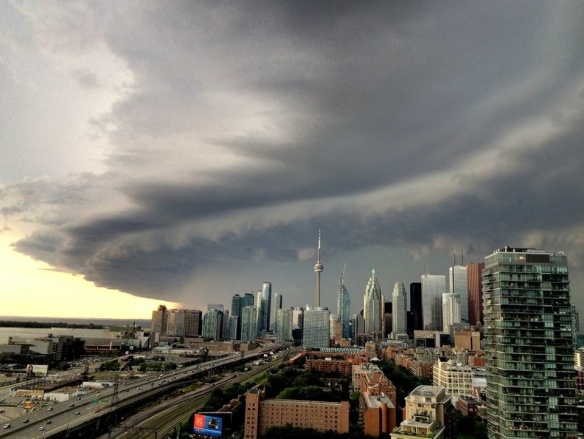
Storm clouds loom over Toronto skyline, 03 August 2015 (CTV News)

Storm clouds loom over Toronto skyline, 03 August 2015 (CTV News)


Environment Canada has confirmed an EF-2 tornado touched down in Teviotdale, northwest of Kitchener-Waterloo, Ontario after violent storms ripped through Southern Ontario on Sunday causing wind damage and minor flooding from heavy downpours.

The tornado hit around sunset from the west and struck a house in Teviotdale just before the residents were able to reach their home.

A teenager in Kincardine reportedly drowned off the Lake Huron town’s pier as the storms were ramping up.

A wind gust of 110 km/h was recorded at Grand Bend while Toronto’s Pearson Airport had peak winds of 94 km/h which downed power lines, uprooted trees and knocked over trailers and small buildings.

Forecasters are investigating more possible tornado touchdowns in Southern Ontario.